This is Part 1 of 6 of my NCT/Lake Superior Adventure.
My journey began with a short ride on the Sea Hunter from Grand Portage, Minnesota. There were many day-hikers onboard, but only one other backpacker, Keith. He was planning to do a counterclockwise loop on the Minong Ridge and Greenstone Ridge Trails.

On the way we visited a special tree growing out of a rock on Minnesota’s north shore.

There were views back to Minnesota’s Sawtooth Mountains. I thought ahead to future experiences on the Superior Hiking Trail.

Day 1: Windigo to Siskiwit Bay (18.8 miles)
After arriving in Windigo, Keith and I had to do a short orientation with a ranger and acquire our backcountry permits. Soon I was on the Feldtmann Lake Trail, away from the day-hiking crowd that arrived on the ferry.

Hiking time was short after the boat ride, so I hiked fast to get to Siskiwit Bay.

There were beautiful sections of trail in the forest.


After arriving at Feldtmann Lake, I took a short break to enjoy the view and eat some food.


I was tempted to hike the Rainbow Cove Trail but opted to join the Feldtmann Ridge Trail. Soon I was at stunning views overlooking Feldtmann Lake and further inland!


After dropping back into the forest, I spotted a fox staring at me in the trail for a moment. It soon disappeared into the woods.

There was a moose antler on the ground, a common sighting around the island, especially at trail junctions.


Nearly five miles from Feldtmann Lake, the Feldtmann Lookout Tower provided panoramic views that were somewhat limited due to clouds.


The trail to Siskiwit Bay was at times overgrown by undergrowth, but there were beautiful flowers to enjoy.

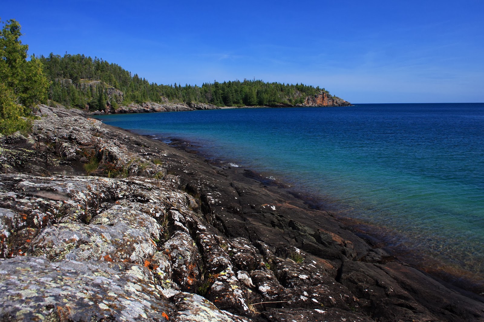
I arrived at Siskiwit Bay and found a shelter for the night. There were a few others around: some hikers and boaters.


Day 2: Siskiwit Bay to West Chickenbone Lake (24.3 +.6=24.9 miles)
I slept in a little the next morning and began my hike on the Island Mine Trail. The trail hugged the beach with views back to the dock and then went inland to cross the Siskiwit River before returning to the bay on Carnelian Beach.


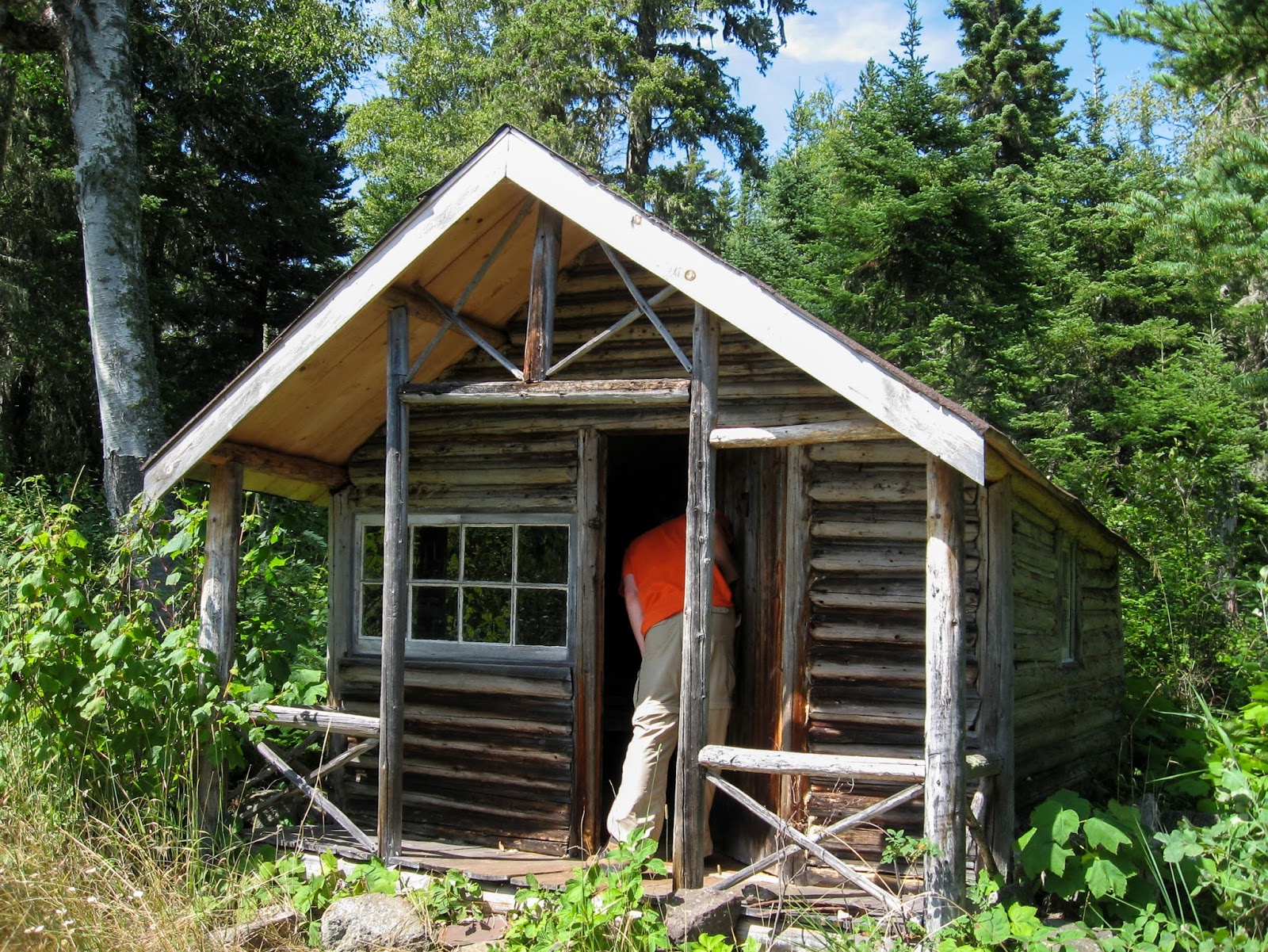
Soon I was back in the lush forest and I came to the historic Island Mine site.


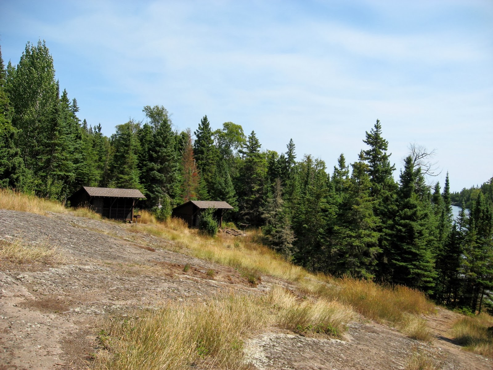
I stopped by the Island Mine Campground for a break. It is the only campground on the island not located near a large body of water. The stream near it was flowing nicely.
Back on the trail there were some boardwalks.

Upon reaching the Greenstone Ridge, I was surprised that it was so forested in contrast to my hiking adventures on the east side of the island. See here: Isle Royale Adventure 2010. The trail was gentle and made for easy walking.


I didn’t stay in the lowlands for long as the trail soon climbed to Isle Royale’s highest point, Mount Desor which remained wooded. As the trail neared Lake Desor, the views opended up.

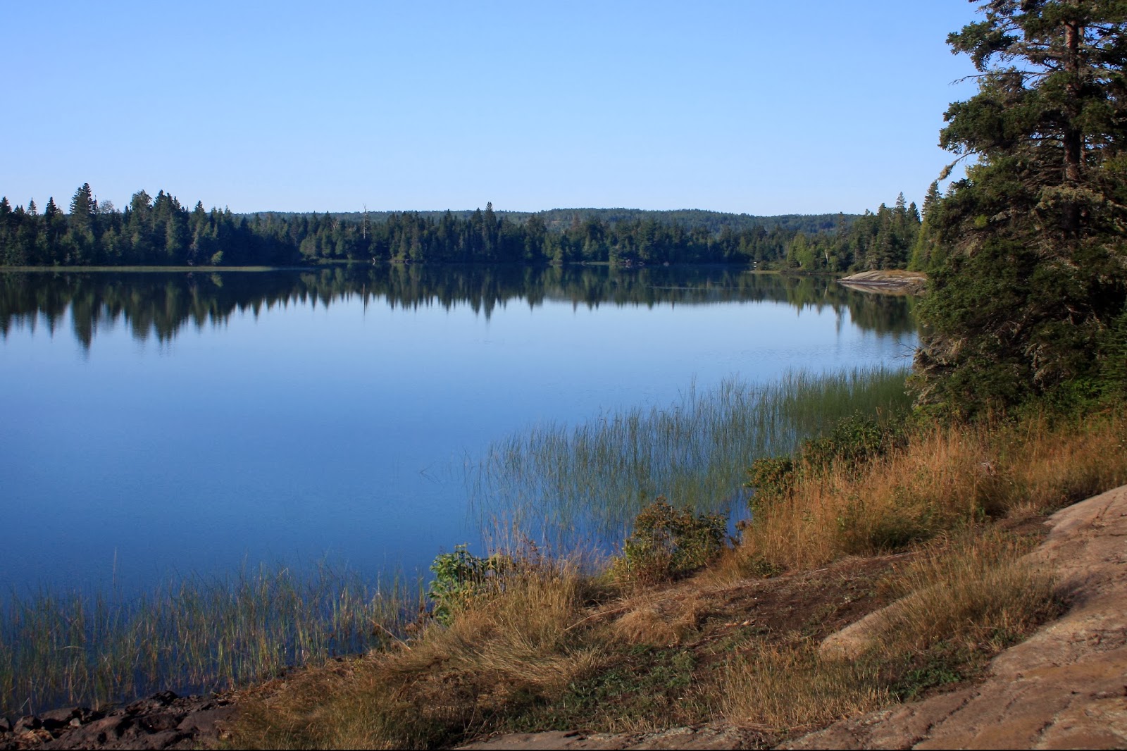
After descending to the junction to South Lake Desor Junction, the Greenstone climbed up to Ishpeming Point and its lookout tower, a single level tower with surprisingly no views above the trees. Further east I was rewarded with a view of Isle Royale’s largest lake, Lake Siskiwit to the South.

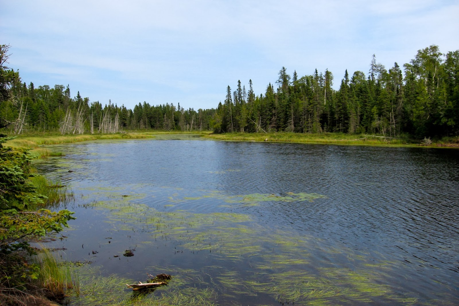
After a quick descent, I came to the Hatchet Lake junction and decided to check out the lake and get some water.


Back on the Greenstone, it was cloudy as I started my longest and final section of the day. There were some ups and downs and some ridge walking as the trail went past Mount Siskiwit, but the clouds remained, obscuring some views or Harvey Lake and Lake Superior to the North.


After a long day I finally arrived at West Chickenbone campground and found a nice campsite on the north end of the campground. There were a few others camped nearby.

Day 3: West Chickenbone to Lane Cove (12.7+10.2=22.9 miles)
From West Chickenbone I was on familiar trail from my 2010 Isle Royale Adventure with nice views back on the Greenstone, including many inland lakes down below the ridge. Some cloudiness remained.


I passed the Mount Ojibway Fire Tower and continued on the Greenstone to Mount Franklin for an impressive view to Canada!


A short distance east of Mount Franklin, I came to the junction to both Lane Cove and Rock Harbor. I continued straight on the Greenstone and dropped my pack for the out and back to Lookout Louise.


Lookout Louise provided a view reminiscent of the San Juan islands in Washington state with views over Duncan Bay.

Without a heavy pack I decided to trail run back to the trail junction. It was relatively warm out so I decided to drop down to Duncan Bay on the portage to get some water and go for a refreshing swim.


Soon I was on the Lane Cove Trail, which was not all downhill from the ridge as it involved going over additional ridges. I arrived at beautiful, but full, Lane Cove campground. Cameron and Connor invited me to join them in their campsite. They had just arrived in Rock Harbor earlier in the day.

Lane Cove has beautiful campsite right by the water. We were able to hear the call of the loon and enjoy beautiful evening colors.

Cameron and Connor weren’t quite sure about their itinerary as it was their first time on Isle Royale and wanted to get the best experience while there. Mileage estimates in guidebooks are fairly low if someone is willing to hike 8-10 hours/day so I discussed the route I used back in 2010 at a faster pace. They planned to head over to Moskey Basin, one of my favorites!

Day 4: Lane Cove to Moskey Basin (23.3 miles)
In the morning I met John, who had been sleeping when I arrived. He had driven throughout the night to get to the boat ontime. He met Cameron and Connor on the boat and decided to hike with them.


The climb back up to the Greenstone from Lane Cove was probably the most intense climb I did while on Isle Royale. At the ridge, I couldn’t pass up revisiting Mount Franklin for an early morning view. From its rocky ledge summit, it could quite possibly be the best view in Michigan.


I continued down the Mount Franklin Trail, passing a nice pond on the way.

I then joined the Tobin Harbor Trail on my way to Rock Harbor.

After reaching Rock Harbor I went out on the popular Stoll Trail loop to Scoville Point. It reminded of the scenery seen on Lake Superior Provincial Park’s coastal trail in Ontario.
The Stoll Trail is named after Albert Stoll Jr., Detroit News editor whose “untiring efforts made possible the preservation of Isle Royale National Park.”


I returned on the other side of the loop with views of Tobin Harbor.

Rock Harbor felt like the half way point of my Isle Royale adventure as I began returning to Windigo on the Rock Harbor Trail.


I took the short side trip to Suzy’s cave, which is said to have been formed by Lake Superior’s waves when water levels were higher.

I continued along the trail passing Three Mile campground, the park headquarters on Mott Island, the Rock Harbor Lighthouse, and Daisy Farm campground on my way to Moskey Basin. I found Cameron, Connor, and John as I looked for a shelter. Moskey Basin is one of my favorite campgrounds with shelters located on rocky ledges mere feet from the water.

I talked to Cameron, Connor, and John for some time about exciting adventures around the U.S. Connor and Cameron planned spend the next night in McCargoe Cove so we’d be heading the same direction the next day. John was heading back to catch the boat.
Day 5: Moskey Basin to Little Todd (23.0 miles)
There were great morning views of Moskey Basin.


After leaving Moskey Basin, it was a short hike to Lake Richie.


Continuing on the Indian Portage Trail, I had my second, third, and fourth moose encounters on the island. It was a cow and two calves. They were quite hungry and didn’t have any desire to leave the trail. I made sure to give them some space, but there was no way to pass due to thick underbrush. They made their way down the trail and I followed slowly behind. Eventually they disappeared when the trail came to a boardwalk.

I ran into Cameron and Connor near Lake Livermore and we hiked together to McCargoe Cove crossing the Greenstone and passing West Chickenbone lake.

We arrived at McCargoe Cove and it was still quite early in the day. I ran into Keith again and he gave a report on the Minong Ridge Trail. He had an invigorating jump off the dock! While enjoying a snack, we watched some loons as they came close and dove under the water frequently.

After wishing the guys a good rest of their journeys, I was off on the most rugged trail on the island, the Minong Ridge Trail. The trail remained familiar for the first mile to the Minong mine.


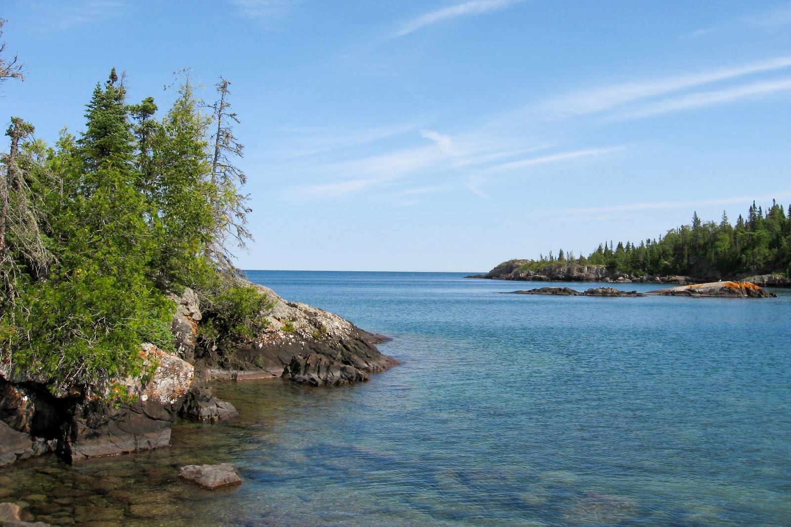
There was a great overlook of Otter Lake and I could see two swans down far below with Lake Superior and Canada in the distance.


I stopped for a break at Todd Harbor in Pickett Bay. There was a boat coming in to pick up some hikers on the dock.

From Todd Harbor the trail was mainly through the woods. I passed the Hatchet Lake Trail which provides the last access to the Greenstone Ridge.

Little Todd campground was small but certainly one of my favorites with campsites on the north shore of the island in Little Todd Harbor. I did a little fun scrambling along the coastline.


Another hiker was camped nearby and she came by to chat for a little while. She discussed how she felt that the Isle Royale experience was quite similar to canoeing the boundary waters. She had day-hiked over to Lake Desor and informed me of many great views to come.


As soon as the sun set, the mosquitoes came out with a ferocity unlike any other during my entire NCT/ Lake Superior adventure. I had left my tent unzipped and they were everywhere inside my tent. Unable to eliminate them all, I opted for my head net. As I looked out over the lake, I had the exciting view of flashes of lightning from an approaching thunder storm. I made sure my tent was set up adequately in preparation. When it arrived, it was a thrilling experience.
Day 6: Little Todd to Huginnin Cove (20.1 miles)

The next morning I was soon up high on the ridge. This is what I had expected in this trail: moderate elevation changes, quite rocky, and following cairn to cairn.

I had views back to previous experiences on the Greenstone Ridge…


Water isn’t quite as frequent on the Minong Ridge so I dropped off it to North Lake Desor camp for some water. The lake is one of the largest on the island.

Back on the Minong Ridge, I began the most remote stretch on the island. It was a stretch greater than ten miles without a trail junction or campground. The views remained stunning.


The trail left the high ridges and spent some time in the forest.


The Minong ascended and descended at least four ridges, descending to beaver ponds in between. The crossings were on the dams and at times, quite muddy.

After completing the long stretch, I finally arrived at the trail junction for the East Huginnin Cove Trail. I was rewarded with a special section of trail hugging the coast for the last mile Huginnin Cove.


Huginnin Cove campground is quite small compared to the busy campgrounds near Rock Harbor. It only has five campsites (maybe 6), but somehow there were still two available even though Huginnin Cove is only a little more than 4 miles from Windigo. I found a great campsite in site number 5, I believe. On the posted campground map it looked like it just went into the woods, but there is actually a personal cove on a short connecting path.


I met some other hikers who were in site number one and they invited to come view the sunset from their campsite.

I did some scrambling around the eastern point of my cove for some great Superior evening views.

Day 7: Huginnin Cove to Windigo (4.3 miles)
I slept in a little the next morning before my short hike back to Windigo.


Soon I was back in Windigo and my Figure 8 route of Isle Royale was complete. I stopped by the store for some snacks, but was somewhat disappointed with the lack of selection as I was craving ice cream. I still had some time so I listened to an informative ranger talk about the moose of Isle Royale.

This was a great week-long adventure on one of the most remote national parks in the nation. It has been said that more people visit Yellowstone in a day than the number who visit Isle Royale in a year. Outside of off-trail hiking, the route I took hit almost all the top sites on the island. I have yet to hike the Ishpeming Trail to Siskiwit Lake and I hiked to Chippewa Harbor in my past experience at Isle Royale. Planning a long distance route is somewhat challenging as the ferry schedule needs to be considered.
Impressions: 99% of Isle Royale is designated wilderness but the real wilderness is found on the Minong Ridge where I only saw one other hiker except for Todd Harbor. The eastern side of the island is more developed with larger campgrounds and lodges. The way wilderness was managed at Isle Royale played a key part as a foundation of the Wilderness Act of 1964.
Most hikers on the island are content to hike short distances at less than ten miles/day. This means they either stick to one side of the island or are stuck paying more money for a ferry around the island. If Isle Royale is looked at from more of a “thru-hikers” perspective the opportunities for travel across the it and back are readily available. The exciting aspect of such a hike is that very few miles of backtracking are needed.
I hiked this in late August. Ideally, I believe this hike should be done later in the season. I still encountered several large groups of people out on the trail and later in the season it will be more isolated if that is something you desire. Also, there will be less worry about finding a campsite when coming in late in the evening. Fall colors will also add another dimension to the Isle’s beauty and there will be less bugs.
Overall, Isle Royale offers the most remote backpacking experience in Michigan and is certainly one of the best options for a 100+ mile hike in the Midwest. The campsites are the crown jewel of this park. Almost always situated on a pristine inland lake or mighty Lake Superior itself. It’s nearly impossible to pick a poor campsite. The only exception is East Chickenbone. I have not heard good things about it, but haven’t stayed there myself. My top four campgrounds are Huginnin Cove, Little Todd, Moskey Basin, and Lane Cove. Wildlife is also a top attraction at Isle Royale considering the significant amount of Moose and Wolf research. There are also fox, beaver, loons, snakes, and toads.
After returning to Grand Portage, I drove slightly north for an impressive overlook of Isle Royale from Minnesota’s north shore.

I then drove to Minneapolis to fly to my classmates’ wedding in Maryland before returning to Minnesota nearly a week later to begin part two of my NCT/Lake Superior Adventure on the Superior Hiking Trail.
Continue to Superior Hiking Trail: Duluth Section